Sydney West Airport and agribusiness lands
The site promoting the adjoining Agribusiness zoned lands directly on the western boundary of the new Western Sydney Airport.
WHO WE ARE
01
Landowners on the western boundary of the new Western Sydney Airport

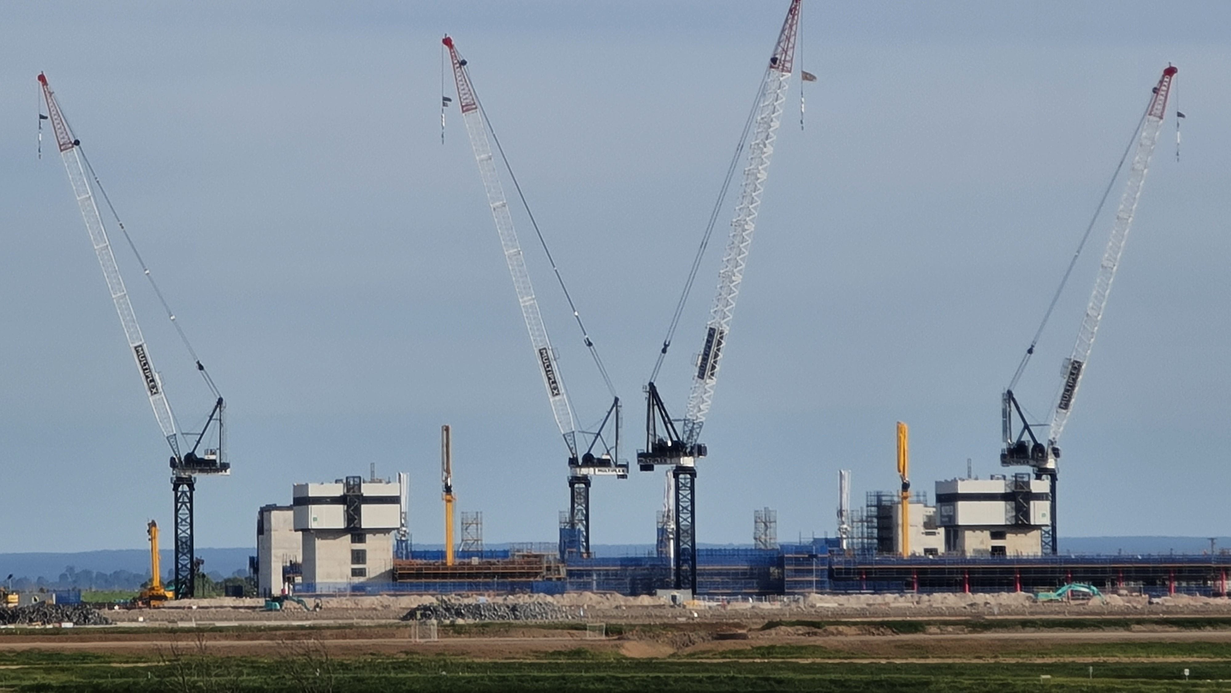
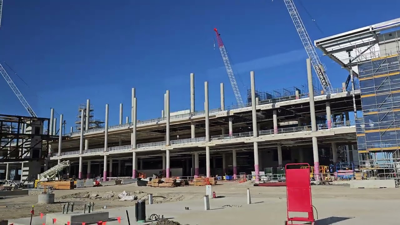
Above - July 2022 photograph of new Airport Terminal building under construction by Multiplex as visible from the landowners site.
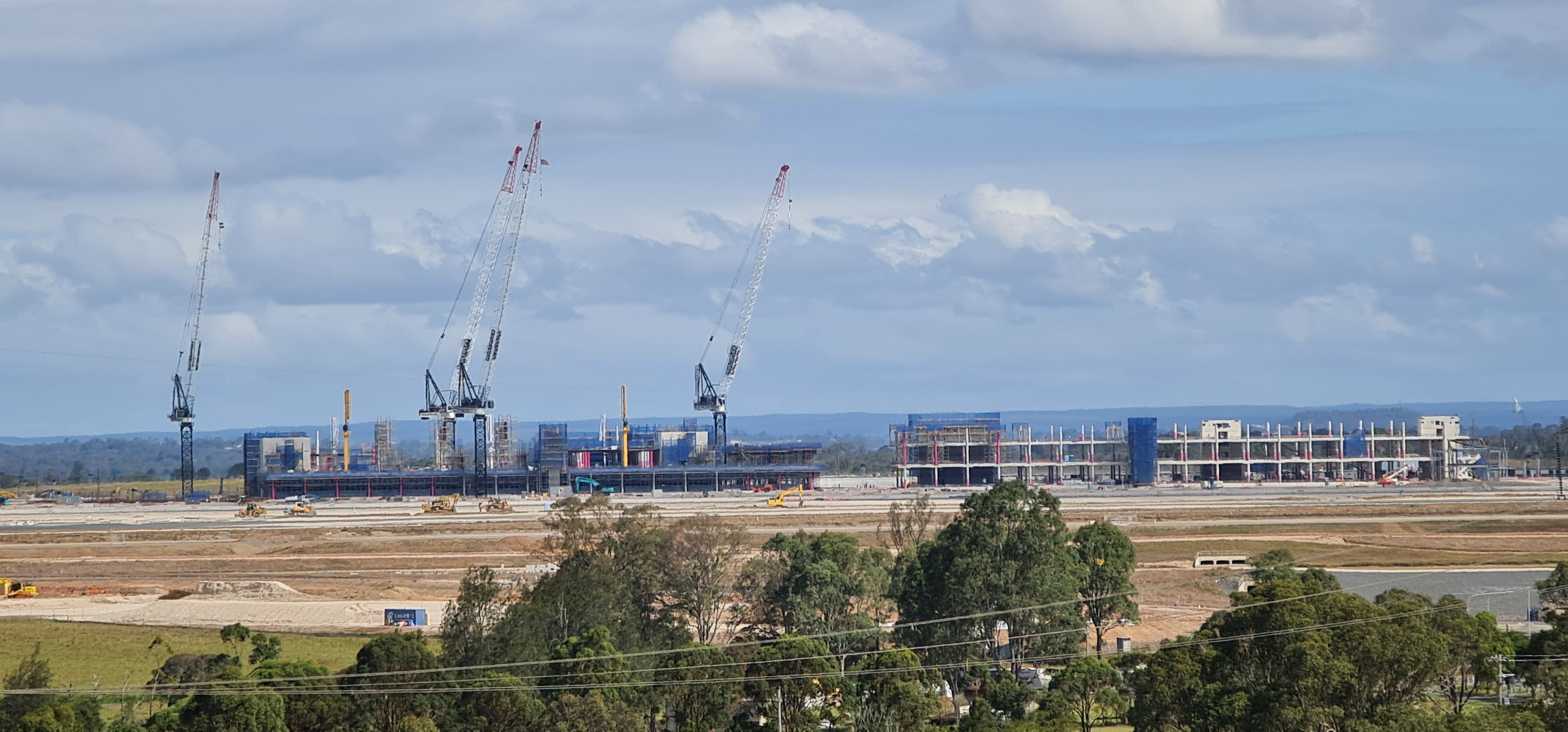
Below - November 2022 photograph of the new Airport Terminal building under construction by Multiplex on the airport site.
This website seeks to show the progress on the airport site as seen from the landholdings on the western boundary of the airport.
The landowners also seek to promote their landholdings as one of the best areas to develop within the Aerotropolis by informing of land uses that can be undertaken and controls relating to development on their lands.
The presentation of the overwhelming positive attributes of the land in relation to location, transport and servicing of these lands and of the area are also one of the objectives of this website.
This site is owned and managed by landowners located on the western edge of the Western Sydney International (Nancy Bird Walton) Airport.
These landowners have been part of the Luddenham Landowners Consortium and have been working with government and other agencies since 2018 for an outcome that will be suitable for land owners and which will align with the commercial and environmental goals of the Western Sydney Airport.
The landholders on the western edge of the airport form one of the largest continuous holdings within the Aerotropolis and have some of the best landholdings for future development.
The landowners seek to fulfil their future aspirations while recognising the traditional owners of the land, and all future custodians of their lands and country.

The photos above and below shows the view of the lands towards the western boundary of the Western Sydney Airport as seen in January 2023.
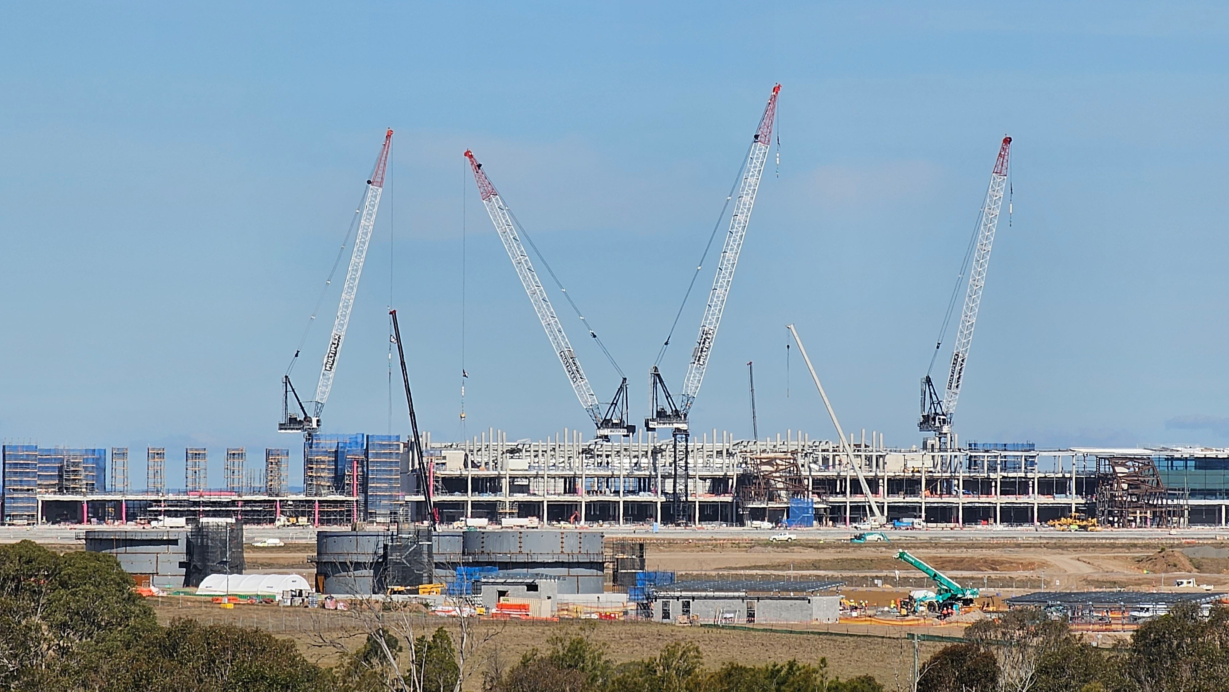
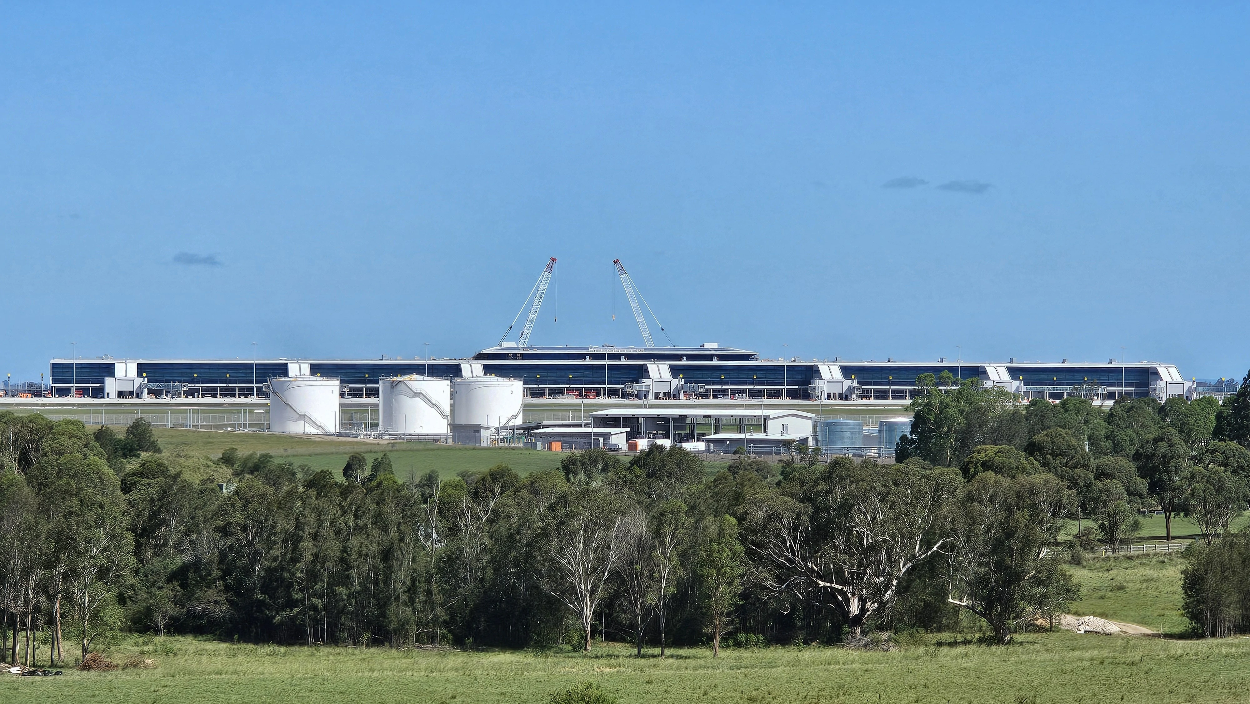
The photo above is closer view of the Airport Terminal Building and Fuel Farm area as seen in August 2023.
Photo to the left shows the views of the lands towards the Airport (February 2025).
Western Sydney Airport
02
The new Western Sydney Airport
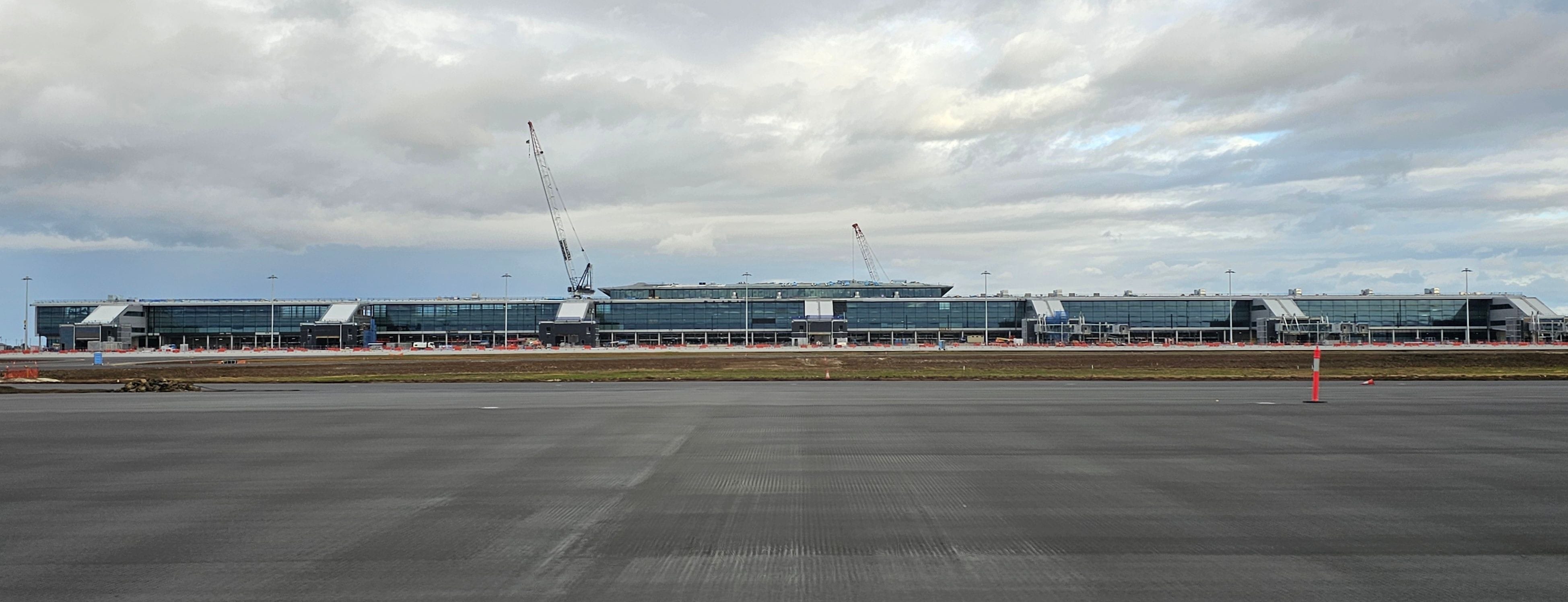
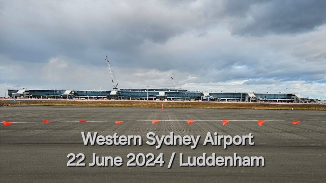
Above - June 2024 photograph of the airport terminal building as seen from the runway.
Below - Stage 1 Airport Land Use plan and landowner locality on the western boundary of the site.
The airport is known as the Western Sydney International (Nancy Bird Walton) Airport. The construction of the airport is well underway and works are to be completed for an airport opening in 2026.
The airport will be a 24 hour curfew-free operating airport.
Costing an estimated $5.3 billion AUD, construction on the airport commenced in September of 2018 after the site was officially designated for an airport in April 2014.
The airport will initially operate as a single runway airport, with the western runway being constructed to open in 2026. This western runway is closest to the landholdings on the western boundary of the airport in Luddenham. Works on the second stage eastern runway are expected to only be needed in 2050 or later.
Disclaimer – This website is not associated with the Western Sydney International (Nancy Bird Walton) Airport, and is an independent site. Please refer to the Western Sydney Airport homepage for all details relating to the airport.
Disclaimer – This website is not associated with the Western Sydney International (Nancy Bird Walton) Airport, and is an independent site. Please refer to the Western Sydney Airport homepage for all details relating to the airport.

The Aerotropolis
03
The Western Sydney Aerotropolis is a land use planning package for the development of lands surrounding the Western Sydney Airport
.jpeg)
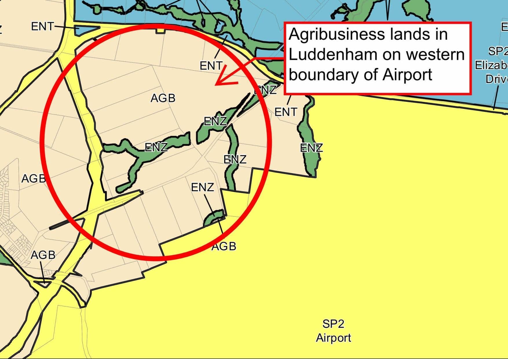
The location of the lands on the direct western boundary of Western Sydney Aiport is shown in the zoning plan extract above.
The lands are directly adjacent to the runway being constucted for the Aiport. The lands are served by The Northern Road, Elizabeth Drive, and the new connecting roads such as Anton Road North, Adams Road and the M12 Motorway.
The Western Sydney Aerotropolis is the land use town planning package involving re-zoning and development plans that applies to land around the airport and what will be known as the Western Parkland City.
The Aerotropolis will become a thriving economic centre in Western Sydney. Benefiting from its proximity to the new airport, the Aerotropolis will contribute towards 200,000 new jobs in the Western Parkland City and become a high-skill jobs hub across aerospace and defence, manufacturing, healthcare, freight and logistics, agribusiness, education and research industries.
The Western Sydney Aerotropolis has several planning documents that apply with the main ones being:• State Environmental Planning Policy (Precincts – Western Parkland City) 2021 – the Aerotropolis SEPP.• The Aerotropolis Precinct Plan.• The Western Sydney Aerotropolis DCP.
The landholdings on the western edge of the airport are within the Agribusiness Precinct which is an initial precinct. The planning packages for this area were finalised on 25 March 2022 allowing for development to commence and these will become the first areas for development within the Aerotropolis.
The Bradfield Development Authority (previously the Western Parkland City Authority - WPCA) is a NSW Government authority overseeing much of the development of the Aerotropolis. The Luddenham Landowners Consortium have recently been a part of the process for determining the location of the Integrated Logistic Hub Airfreight Interface Concept for the Western Sydney Airport proposed by the WPCA. The lastest report is now also available showing this progress. The landholdings on the western edge of the airport have the best land attributes for development within the whole Aerotropolis, including unmatched transport, servicing, location and common stakeholder land ownership.
Contact us if you would like more information on the potential for development that could be undertaken on these lands. Note that for specific site advice, you should speak to a town planner or other planning specialist.
.jpeg)
agribusiness and development around the airport
Contact is through the email below for further details.